CASE STUDY
Landscape Character Assessment
South Oxfordshire, UK
Project Type
Landscape Character Assessment
Client
South Oxfordshire District Council
Location
South Oxfordshire, UK
Keywords
- Limestone grassland
- Arable landscapes
- Chilterns AONB
- North Wessex Downs AONB
This project was commissioned to inform the Local Plan and in particular to help inform policies on character, built design and protection of the countryside. It will also be used by Neighbourhood Planning Groups to inform their plans.
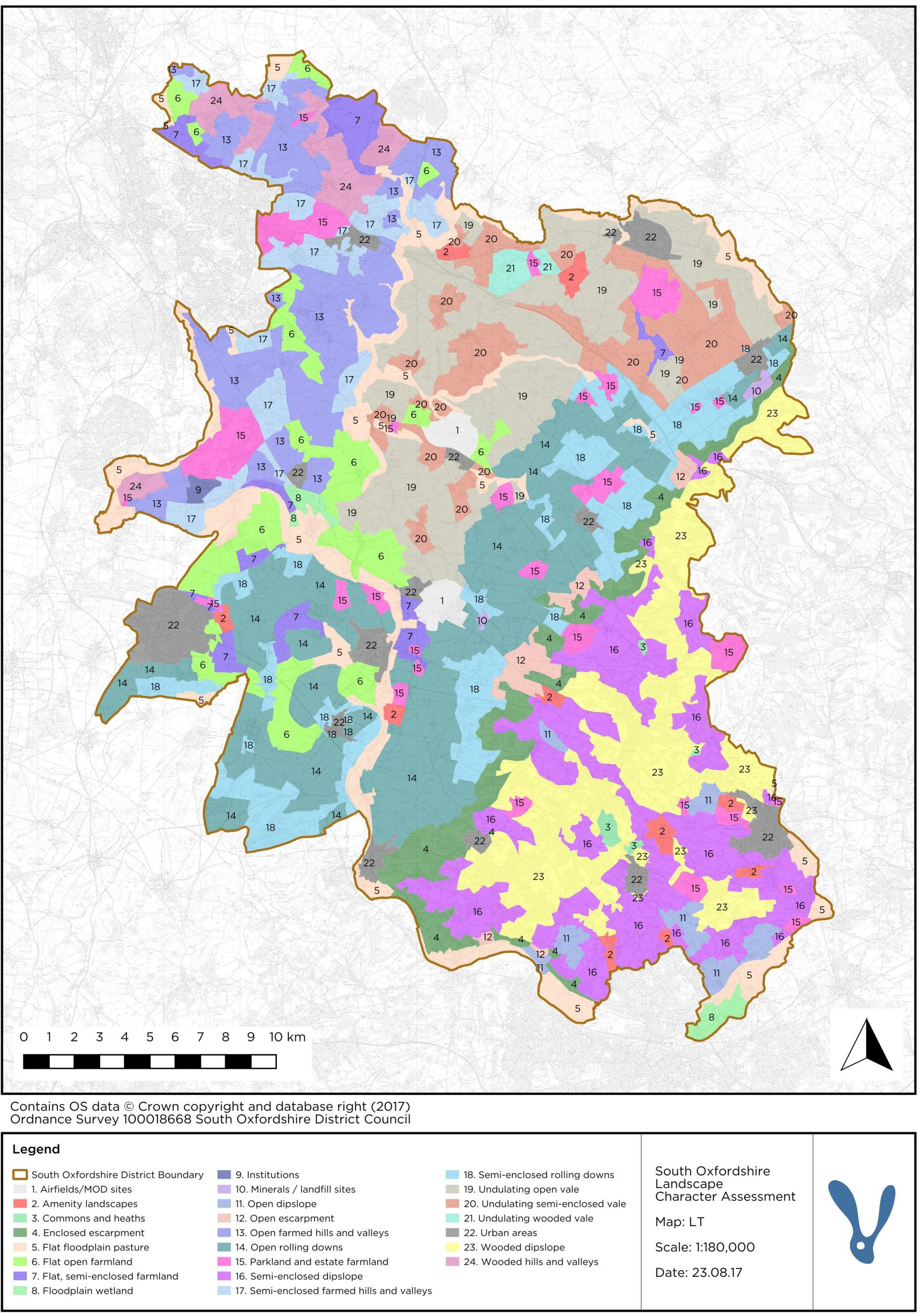
The LCA for South Oxfordshire was prepared using GVLIA3 and the Landscape Character Assessment Guidance prepared by Natural England in 2013. The district of South Oxfordshire covers nearly 260 square miles. Its boundary reaches from the edge of the City of Oxford in the north west along the border of Buckinghamshire and Berkshire, to the outskirts of Reading in the south. It has four main towns: Didcot, Henley, Thame and Wallingford, with Didcot becoming increasingly dominant as the main urban centre. LCAs and associated LDUs were prepared for 11 Landscape Character Areas including:
The Oxford Heights - focused upon the northerly, higher hills of the Mid-vale Ridge which surrounds Oxford to the east, and including the fringing lowlands of Otmoor and the Rivers Ray and Thames.
The Nuneham Courtenay Ridge - comprising the southerly part of the low limestone hills of the Mid-vale Ridge, which appears as a prominent spur of higher land above the River Thames which bounds it to the west and south
The Clay Vale - embracing the low-lying, gentle landscape which overlies the Gault Clay across the centre of the district.
The River Thames Corridor - low-lying alluvial land which forms the corridor of the River Thames between Long Wittenham and Goring and includes the lower reaches of its main tributary, the River Thames.
The Eastern Vale Fringes - the easterly part of the ‘shelf’ of Lower Chalk and Upper Greensand which forms a belt of higher rolling ground between the low-lying vale and the steep Chilterns escarpment.
